On May 23 2015, I went biking on the Alum Creek Trail's northern section. For those of you who aren't familiar with it, the Alum Creek Trail is currently divided into three sections. The northern section runs as far south as the athletic fields near Easton, and connects to Westerville's trail system on the north end. The middle section is currently the smallest, with the northern terminus at Innis Park. The southern section begins just north of Bexley, and ends at Three Creeks Park, where it connects with the Blacklick Creek Trail.
As of the summer of 2014, plans were underway to build the last segments to connect all three parts of the trail, including two new bridges across Alum Creek. When I'd previously taken this trail, in June 2014, work was just beginning. The most recent update I could find was on columbusunderground.com, and indicated that, as of November 2014, work was expected to finish in early May, 2015. So I figured it was a good time to check if it had indeed finished.
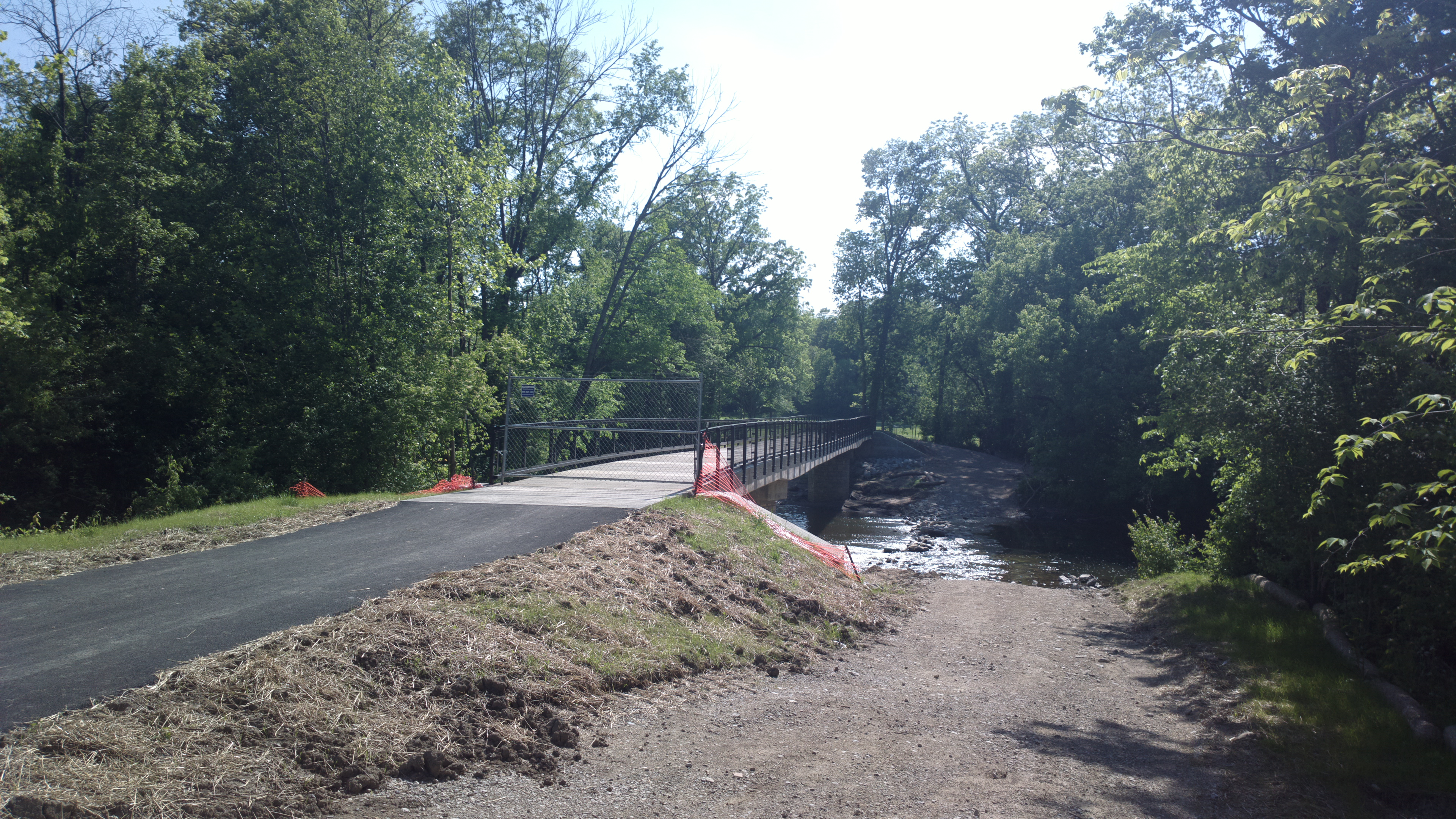
I started on the northern section, in Westerville, and went south. I'd forgotten how nice that section of trail was. Arriving at the south end of the Easton athletic fields, sure enough there was a bridge - but it was not open.
The reason for the bridge's closure was not clear. Walking closer to it, it appeared to be in fine condition.

Perhaps construction had just finished recently. At any rate, it looked like it would be a fine bridge once it was open, and it's quite possible that by the time you're reading this, it already is open.
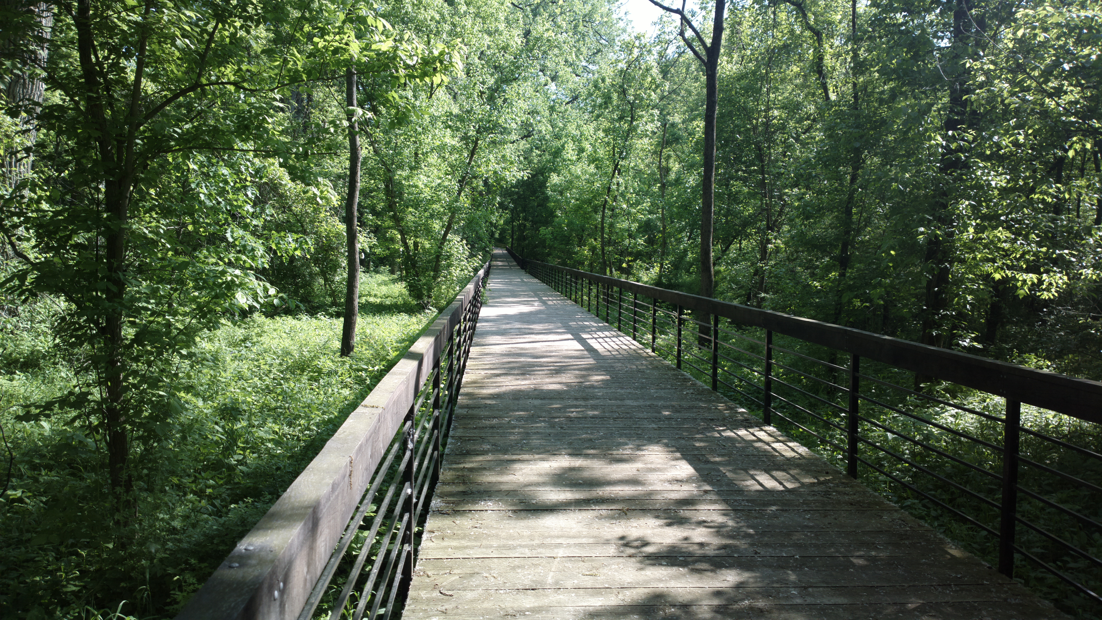
Hopping over to the central section of trail, the trail does extend north past Innis Park. The northern terminus of the central section is now a boardwalk, which ends in a gate as well. The reason for its closure is also unclear - it looks like there's no construction impediment to opening the last fraction of a mile to the bridge, and completing the north-central link. Below, you see the view from the gate looking south along the boardwalk.
The central section continues south, until its current endpoint in the Brittany Hills neighborhood, at the eastern terminus of the Mock-Hudson Connector, which takes you all the way to Tuttle Park and the Olentangy Trail if you follow it as I did. The Mock part of the connector is actually a fairly nice mix of residential neighborhood and dedicated bike trail; the Hudson part and the parts between High Street and Tuttle Park lack dedicated trail. I'd recommend at least the Mock part of it as a nice addition to the standard Columbus trails.
As for the central-southern connector, it was clear enough why that wasn't ready. The bridge, while traversable on foot, was not yet ready for bike traffic.
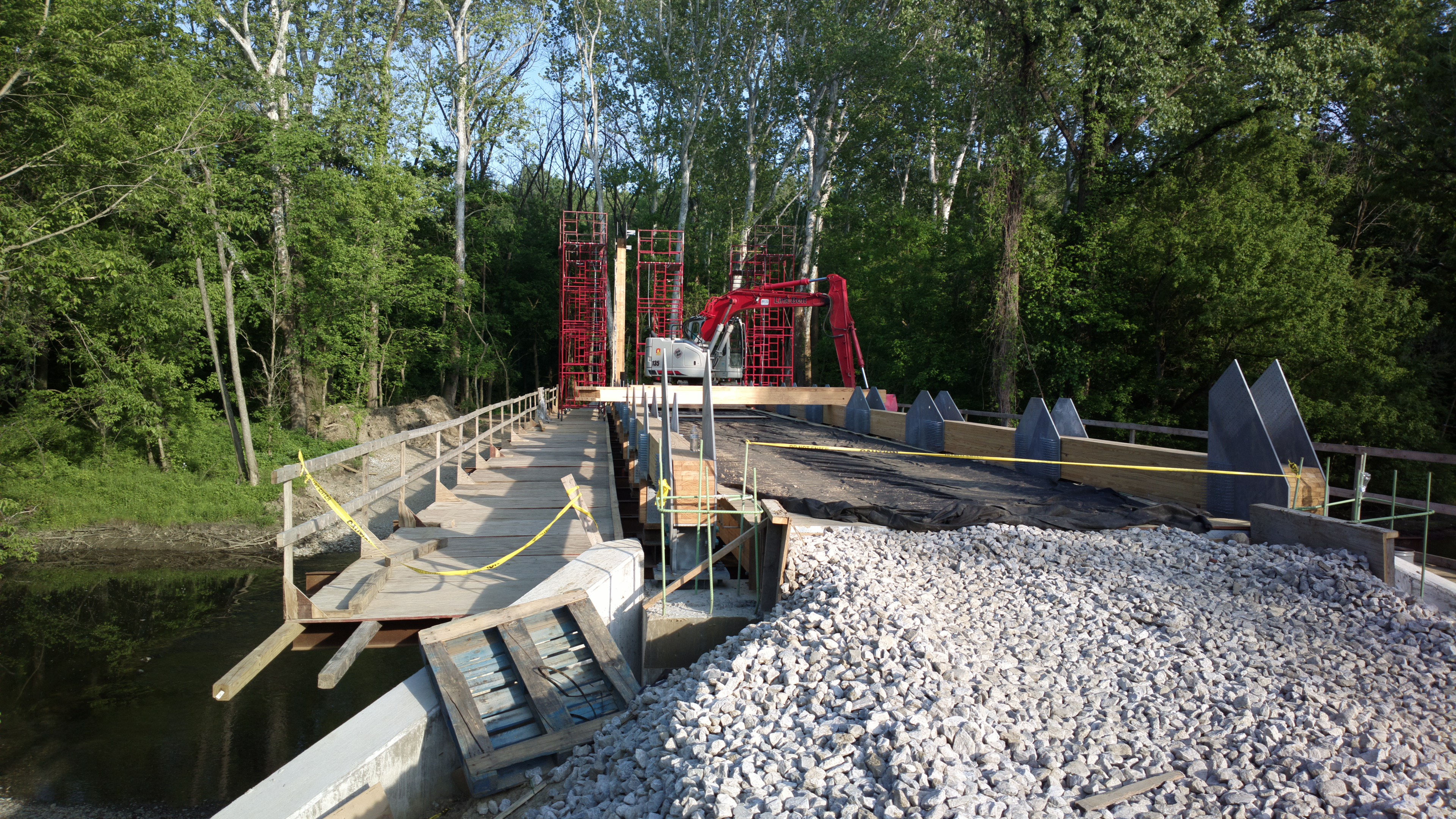 Second Bridge
If this bridge is ready this summer, I expect it to be mid to late summer. Crossing it on food, it was also clear that the trail itself was a work in progress here.
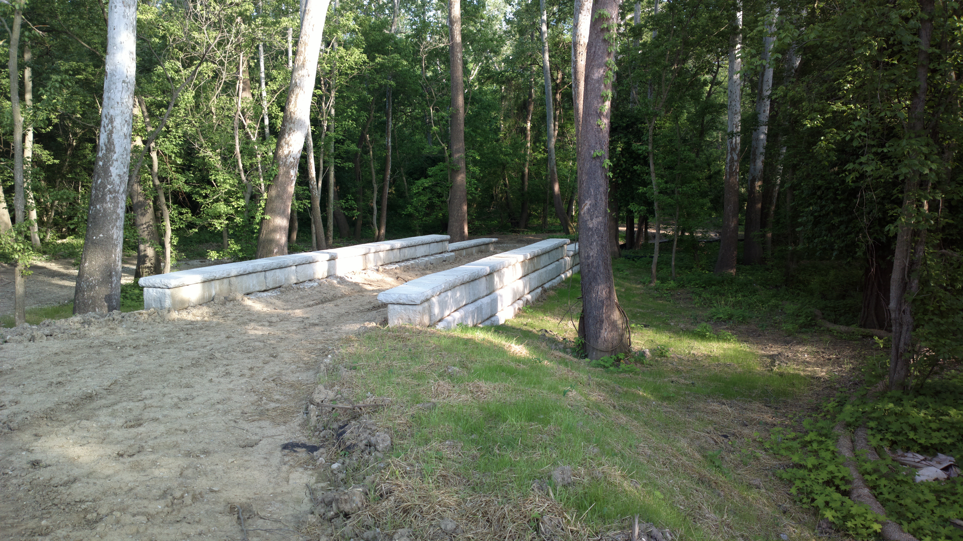
The trail continued on for at least several tenths of a mile unpaved - I didn't traverse the whole amount as I was on foot, it was approaching sunset, and my guess is it's the same until the northern terminus of the southern section. Still, the trail appeared to have been cleared, just not smoothed out and paved yet.
Overall, I was happy to see the progress on the trail, glad that at least one of the connectors was pretty close to on schedule, and look forward to riding the entire trail once it's complete.
Return to Blog Index